Geology of the Black Range. Romsey Australia
Geomorphic Landsystems
Pink area on map denotes geological age greater than 250 million years.Grey area including Romsey denotes geological age less than 1.4 million years
| Geomorphic Unit: | West Victorian Dissected Uplands - Midlands |
| Landform: | Low hill (relative relief 30-90m) |
| Lithology: | Sedimentary rocks ie sandstone, mudstone |
| Lithological Age: | Palaeozoic material greater than 250 million years |
| Climate: | > 700 mm/year; Cool temperature Bassian |
| Landsystem Code: | 2.1LsP7-2 |
| Soil: | 'Yellow earths, Mottled duplex soils' |
| Compaction: | moderately weak |
| Leaching: | high |
| Soil PH: | < 5.5 |
| Mass Movement: | No evidence of any apparent movement, particularly in cleared areas where it would normally be more apparent |
| Salting Conditions: | Areas with yellow clayey soils but in which salt seeps have not been recorded |
| Water Erosion: | High |
| Waterlogging: | Moderately well drained, well drained, rapidly drained |
| Wind Erosion: | Low |
| Area (Ha): | 1398.54221094 |
| Coordinate Position | |
| Latitude: 144° 41' 12" E Longitude 37° 21' 6" S | |
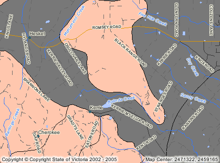
Romsey and surrounding district
Grey area on map including Romsey denotes geological age less than 1.4 million years| Geomorphic Landsystems | |
| Geomorphic Unit: | Undulating PLains - Western District |
| Landform: | Plain above flood level (relative relief <9m) |
| Lithological Age: | Quaternary material less than 1.4 million years |
| Climate: | > 700 mm/year; Warm temperature Bassian |
| Landsystem Code: | 7.1PbfQ7-9 |
| Soil: | 'Red loams, Grey loams' |
| Compaction: | loose, very weak |
| Leaching: | high |
| Soil PH: | < 5.5 |
| Mass Movement: | No evidence of any apparent movement , particularly in cleared areas where it would normally be more apparent |
| Salting Conditions: | Areas with yellow clayey soils but in which salt seeps have not been recorded |
| Water Erosion: | Moderate |
| Waterlogging: | Moderately well drained, well drained, rapidly drained |
| Wind Erosion: | Low |
| Area (Ha): | 12414.08148984 |
| Coordinate Position | |
| Latitude: 144° 41' 27" E Longitude 37° 21' 13" S | |